What the survey needs to show
The central task is mapping what's actually on the ground — buildings, utility lines, encroachments — against the parcel lines. Those features have to be tied to a reliable boundary framework so the resulting survey shows how the occupied and improved property relates to the parcel. A building by itself is only part of the picture — utilities and features extending across or near the framework can matter just as much to the party reviewing the survey.
Start with the actual request from your lender or title company. "We need an ALTA" doesn't settle every part of the scope, because the required Table A items differ from deal to deal. We need to know which additional items have been selected before we can plan the fieldwork and any elevation collection. A precise request gives us a precise job; a vague one leaves room for an important item to surface after the scope is already set.
Table A controls the added scope
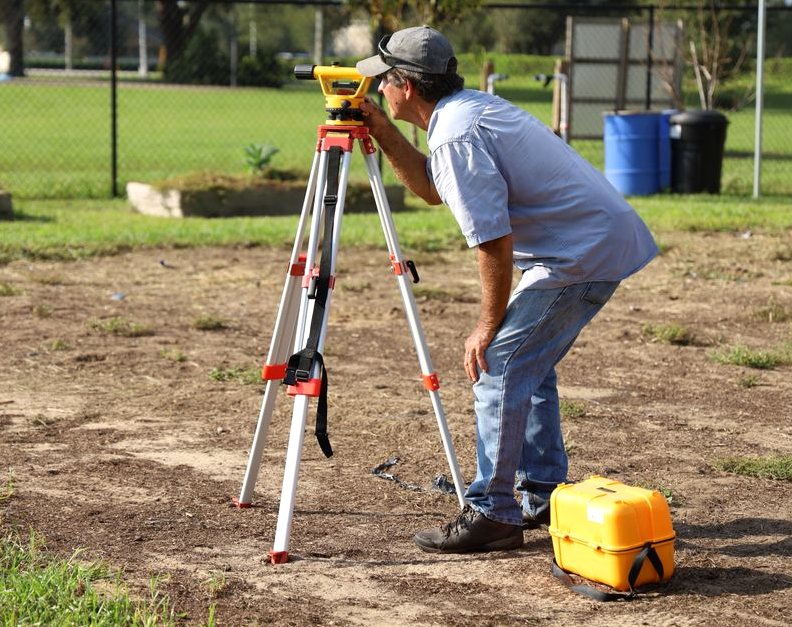
Table A items aren't interchangeable add-ons — each one is specific information the lender or title company wants included. We add only the requested items to the core work and plan the field effort around those selections. If an elevation item is included, our crew uses digital levels to get that data rather than estimating it.
Send us the complete Table A request as early as you can, and if the reviewing party revises it, send the revised version rather than summarizing it over the phone. The wording matters because it tells us what has to be gathered and shown. If someone has called the job an as-built survey or building-permit support, that label alone doesn't tell us which improvements, utilities, encroachments, or elevations are required — we still need the actual Table A list.
How we establish the site framework
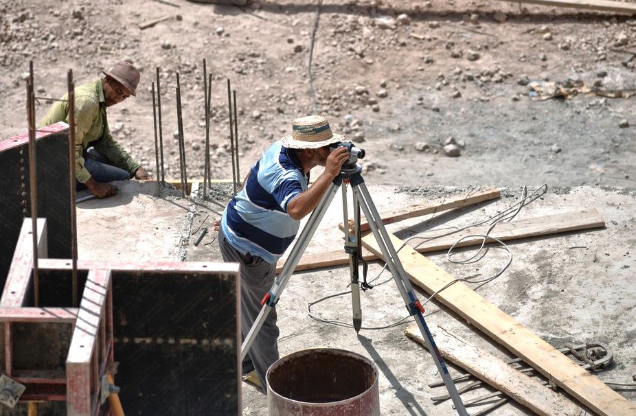
Our fieldwork starts with the boundary framework needed to position the site features. We use monument-recovery tools for that work. Once the framework is established, we position each site feature against it — that relationship is what makes the survey useful, not a loose set of measurements with no parcel reference.
Requested elevation information gets its own field attention, using digital levels for whatever items the client asks us to provide. An ALTA request can combine horizontal locations with selected elevation data, and which elevations get collected depends entirely on the Table A items chosen — we follow the stated scope rather than assuming every lender wants the same package.
Elevations carry extra weight here because of the ground itself. Huntington Beach's lowland areas commonly have Marina, Myford, and Omni soils, so before elevation data gets used to stake additions, slabs, walls, or grade changes, we check drainage and flood-related constraints for that parcel. The city's younger alluvial soils can also have moderate to high expansion potential — wetting and drying moves the ground enough to stress foundations, which is one more reason we collect elevations with instruments rather than estimate them.
What the added items cost
Added Table A items run $150 to $600 each. That's the price per added item, not a total for the whole survey — the number and type of items selected is what drives the added cost.
We price the work from the lender's or title company's actual Table A selections, not a guess at what a typical ALTA runs. If five items are named in an email and a later message adds a sixth, that changes the scope, and we'd rather catch it before the crew is in the field than after.
Get the request aligned first
The cleanest starting point is the written survey requirement, including every selected Table A item. We review that against the features to be located and flag any requested elevation work up front. If there are related documents — a proposed site plan, a permit application — send those too, so we're working from the actual requirement instead of a verbal shorthand.
The useful first conversation is about the property, the lender or title company's requirements, and exactly what the finished survey has to contain. Send that material before the field date, and we'll plan the monument-recovery work, the site-feature locations, and any digital-level observations around the real request instead of a generic template.
A Look at the Work
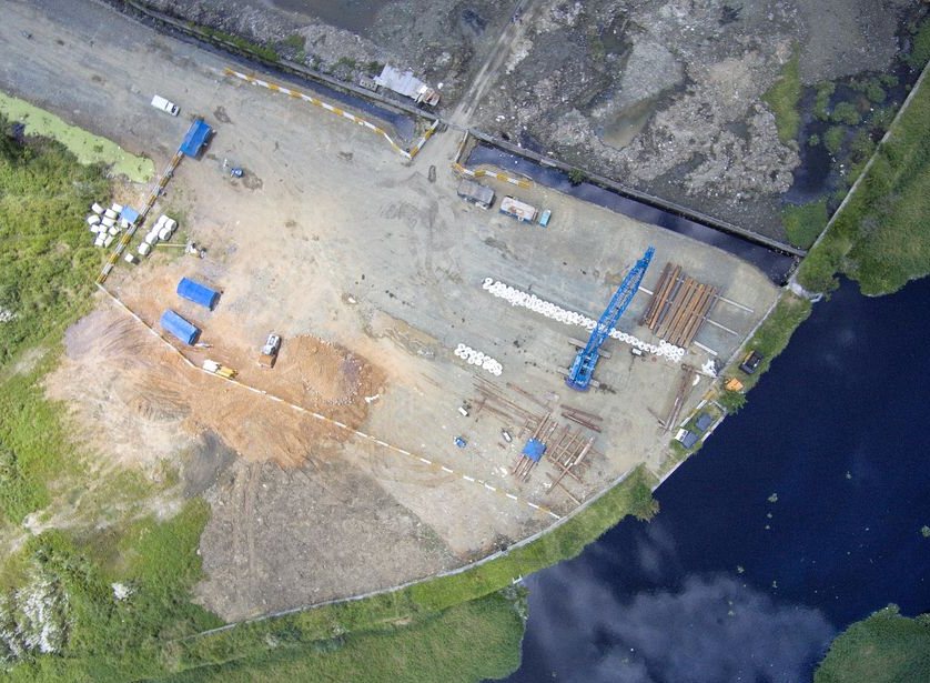
A representative look at the kind of work this covers.
How It Works
-
Tell Us What You Need
Tell us what you need done and when — you'll get a straight answer, not a sales pitch.
-
Free On-Site Quote
We come out, look at the space, and confirm exactly what the job involves.
-
Written Quote
You get the scope and the price in writing before any work starts. No surprises.
-
We Do the Work
Our crew does the work, checks it, and leaves the site clean. You see everything we did.
In practice, on a job like this:
- Locating all improvements, utilities, and encroachments on the site
- Adding the specific Table A items the lender or title company requires
What to Expect to Pay
Typical ranges, not a fixed price - the exact number is confirmed in writing before work starts.
$2000–$4500
Good to Know Before You Call
Price tracks the work, not the lot size alone. A clean platted lot with good corners is quick; a parcel with missing monuments, conflicting deeds, heavy tree cover, or a metes-and-bounds description takes far more research and field time. We quote after we see the deed and the record, so the number is real.
Usually yes, and often the permit requires it. Building to an assumed line is how encroachment problems start — a fence a foot over the line can cloud a future sale. A current boundary survey shows exactly where you can build and keeps the improvement on your own ground.
It's marking the site so the contractor builds in the right place — offset stakes for the foundation, grade stakes for elevations, and layout for utilities, all set from the engineered plans. It's done in stages as the job progresses, which is why it's usually quoted per visit rather than as one flat fee.
A boundary survey with improvements locates visible features and the easements shown in the record — utility lines, drainage, access, and any structures near the lines. A full ALTA goes further. If a recorded easement doesn't show on your deed, the title research is where it turns up, which is one reason the record work matters.
In Oklahoma, only a licensed Professional Land Surveyor can locate and certify a boundary. A recorded plat shows the intended dimensions, but it doesn't tell you where the corners actually sit on the ground — that takes field measurement tied to the monuments of record. A signed, sealed survey is what a lender, title company, or court will accept.
Most residential lots take a few hours in the field once the research is done, but the whole job usually runs one to three weeks start to finish — record research, scheduling the field crew, computing the boundary, and drafting the sealed plat all take time. Acreage and parcels with conflicting deeds take longer.
A boundary survey locates and marks your property lines. An ALTA/NSPS survey is a detailed standard used for commercial real-estate deals — it adds easements, improvements, and specific 'Table A' items that lenders and title insurers require. An ALTA is more thorough and costs more because it shows far more detail.
A Few More Questions
No. A phone's GPS is accurate to several feet at best and isn't tied to your deed or the corner monuments, so the lines those apps draw are approximate and carry no legal weight. Survey-grade GNSS fixes a point to the centimeter against a reference network — a different instrument for a different job.
The property address and, if you have them, a copy of your deed, any prior survey, and your title commitment. Access to walk the property helps, and if there's a specific reason for the survey — a fence, a sale, a building permit — telling us up front lets us scope it right the first time.
Serving Huntington Beach and Nearby
Serving Huntington Beach, CA. Call (657) 485-0473 to confirm coverage for your address.
Also Available
Why Huntington Beach {Who} Call
- Free Estimates
- The first visit and our honest read cost you nothing.
- No-pressure guidance
- You'll hear our honest read, never a hard close.
- We clean up when we're done
- Tidying up is part of the job here.
Straightforward Pricing
Need help today? Call (657) 485-0473.