What You're Actually Paying For
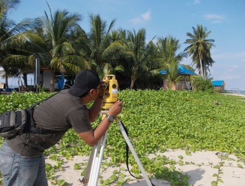
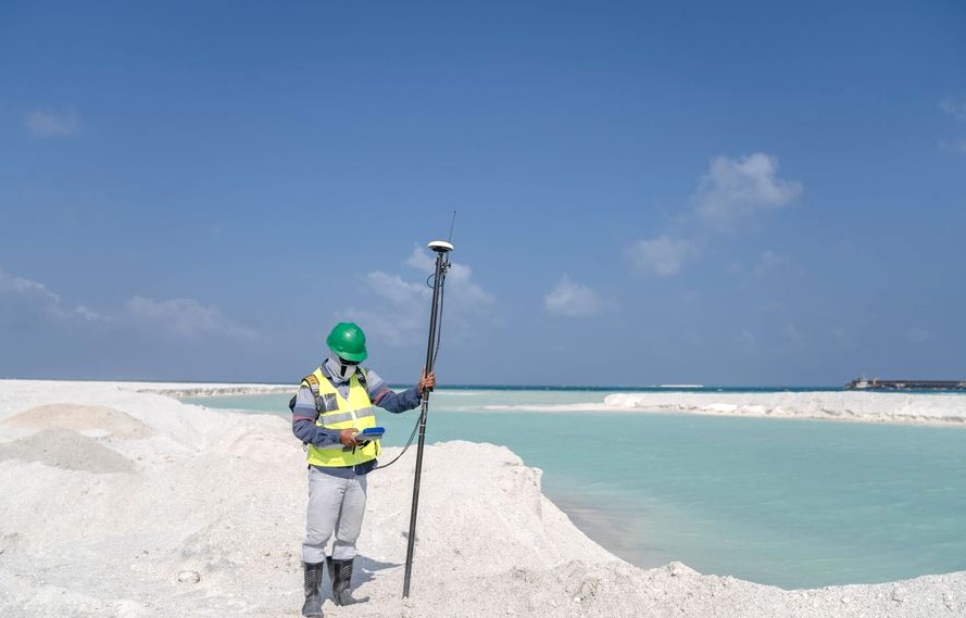
Two halves. The field half is a crew measuring your parcel with GNSS and a total station, tied to the state plane coordinate system so the numbers mean the same thing to every other surveyor, engineer, and city reviewer who touches them later.
The office half is where the hours go. We compute the boundary against your deed calls and resolve whatever doesn't line up — gaps, overlaps, two documents describing the same line differently. Then, where the original corners are gone, we set and stamp new markers and flag them so you can actually see them from the yard.
Before any of that, there's monument recovery. Pin finders and metal detectors, walking the lines looking for the pins somebody set decades ago. On a lot that was platted long before you bought it, that search is often most of the field day — and it's the part that decides whether this is a small job or a big one.
The Two Ranges We Put on Paper
For an ALTA/NSPS land title survey on a commercial parcel, plan on $2,000 to $8,000. That's a wide band on purpose — the ALTA standards let you and your lender pick which Table A items get added, and each one is more research, more field time, or more coordination with the title company.
A FEMA elevation certificate sits at the other end: $350 to $750. That's bounded work — we take the building's elevation, put it next to the base flood elevation for that address, and seal it.
Which band you land in depends on what you actually need answered, not on how big your parcel is.
What Moves the Number
It goes up when the records don't agree. A legal description that calls to a stone or a fence post that hasn't existed for forty years, a parcel that's been split since the last plat, a neighbor's fence sitting somewhere the deed doesn't put it — all of that is time in the office resolving conflicts before anyone sets a stake.
It goes up further with ALTA work, because title-grade means accounting for easements, rights of way, and whatever the current title commitment turns over.
It comes down when the corners are where they're supposed to be. Find the original monuments with the pin finder, confirm them, tie them in, and the boundary practically computes itself. A clean, recent plat on a simple lot is the cheap case. A messy chain of title on a lot that's been carved up is the expensive one — and neither is something we can tell you by looking at a satellite picture.
The Cheapest Way Through This
If what you actually need is to know where your corners are, the smallest version of this is monument recovery on its own — no new map, no title research, no sealed boundary opinion you don't have a use for. It costs less because it stops at telling you where your line is, not at accounting for everything that encumbers it.
A cheap version of the work that misses a gap or an overlap costs you more at closing than the full job would have cost today. When the smaller scope answers your question, we'll say so. When it doesn't, we'll tell you that too.
Crew Day, Weather, and What Turns Up
Yes, coming out costs money. It's a truck, a crew, GNSS receivers, a total station, and then the computation afterward — the visit isn't a free estimate, it's the front half of the job. That's true whether we're setting corners on one lot or running an ALTA on a commercial parcel.
Weather is rarely the problem here. We get occasional light winter freezes, brief enough that they don't sit in the ground long, and the dominant Cropley soil drains well, so we're back on the line sooner after a wet stretch than crews working heavy clay.
What usually turns up once we're out there: a pin that isn't where the plat says, a pin that's simply gone, a fence that was never on the line to begin with. That's the second pass, and it's why we don't quote off the plat alone — this is a built-out city with a lot of old plats, and monuments have had decades to get lost or paved over.
Budget It Before You Commit
If you want to walk into this with a realistic number, bring three things to the conversation: your deed, whatever plat or prior survey you've got, and a clear answer to what you're trying to settle. Boundary question? Closing? Flood insurance? Those lead to different scopes and different prices.
We'd rather tell you which band you're in before we mobilize than surprise you after. And if a smaller piece of the work answers what you need, that's the answer we'll give you.
Call us and we'll quote your specific lot — free, based on your parcel instead of a range on a page.
A Look at the Work
A representative look at the kind of work this covers.


How It Works
-
Tell Us What You Need
Tell us what you need done and when — you'll get a straight answer, not a sales pitch.
-
Free On-Site Quote
We come out, look at the space, and confirm exactly what the job involves.
-
Written Quote
You get the scope and the price in writing before any work starts. No surprises.
-
We Do the Work
Our crew does the work, checks it, and leaves the site clean. You see everything we did.
In practice, on a job like this:
- Recovering the original monuments — the iron pins, stones, or nails that mark the corners of record
- Measuring the parcel with GNSS and a total station, tied to the state plane coordinate system
What to Expect to Pay
Typical ranges, not a fixed price - the exact number is confirmed in writing before work starts.
$500–$1500
$500–$1200
Good to Know Before You Call
A survey establishes where the line legally sits based on the deeds and the monuments of record, and the sealed plat is the professional opinion a court relies on. It won't force your neighbor to agree, but it replaces guesswork with a defensible, licensed determination — which is usually what resolves the dispute or supports it if it goes further.
It's a form a licensed surveyor completes documenting your building's elevation relative to the base flood elevation. You'll need one to buy or reduce flood insurance in a mapped flood zone, or to support a Letter of Map Amendment if you believe your structure was mapped into a floodplain by mistake.
Yes. Where corners are missing we set stamped iron rods or caps carrying the surveyor's license number, and we flag them so you can find them. The markers are part of the record — moving or destroying them is both a practical problem and, in most states, against the law.
No. A phone's GPS is accurate to several feet at best and isn't tied to your deed or the corner monuments, so the lines those apps draw are approximate and carry no legal weight. Survey-grade GNSS fixes a point to the centimeter against a reference network — a different instrument for a different job.
The property address and, if you have them, a copy of your deed, any prior survey, and your title commitment. Access to walk the property helps, and if there's a specific reason for the survey — a fence, a sale, a building permit — telling us up front lets us scope it right the first time.
Price tracks the work, not the lot size alone. A clean platted lot with good corners is quick; a parcel with missing monuments, conflicting deeds, heavy tree cover, or a metes-and-bounds description takes far more research and field time. We quote after we see the deed and the record, so the number is real.
A Few More Questions
Usually yes, and often the permit requires it. Building to an assumed line is how encroachment problems start — a fence a foot over the line can cloud a future sale. A current boundary survey shows exactly where you can build and keeps the improvement on your own ground.
Serving Huntington Beach and Nearby
Serving Huntington Beach, CA. Call (657) 485-0473 to confirm coverage for your address.
Also Available
Why Huntington Beach {Who} Call
- Free Estimates
- The first visit and our honest read cost you nothing.
- A real person answers the phone
- No endless menu — someone who can actually help.
- We work around your schedule
- We fit the job to your day, not the other way around.
Free Inspections
Need help today? Call (657) 485-0473.
Updated September 2026